Ich stehe früh auf, das Wetter ist nach wie vor absolut genial und entschädigt für das schlechte Wetter, das ich im letzten Jahr auf dem West Highland Way erlebt habe.
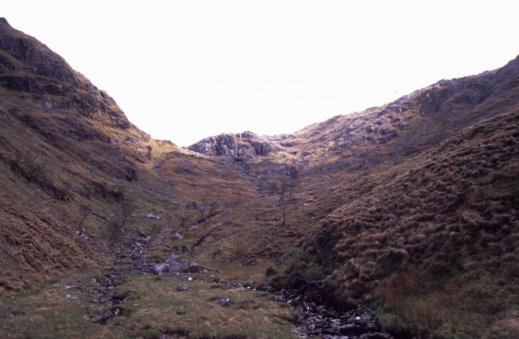
Es geht mehr oder minder wegelos weiter bis zu einer Landzunge und anschließend peile ich eine Brücke an, die über den River Carnach führt. Nach der Brücke ist ein Pfad vorhanden, dem ich Richtung Nord-Osten folge. Bald kommt eine Ruine in Sicht und nehme an, mein ursprünglich für gestern geplantes Tagesziel erreicht zu haben. Komisch ist das trotzdem, denn das Gelände sieht ganz anders aus, als ich es von Bildern der Tourbeschreibung in Erinnerung hatte. Ich bin also falsch gelaufen. Shit. Karte und Kompass raus. Ich bin dem falschen Fluß gefolgt. Der Allt Achad a’ Ghlinne verläuft nach Osten, ich hätte einem anderen Bach nach Norden folgen müssen. Also wieder zurück zur letzten Flußquerung und einem kleinen unscheinbaren Bach nach Norden folgen. Und siehe da – es dauert nicht lange und ich stehe vor der „richtigen“ Ruine.
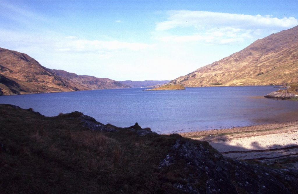
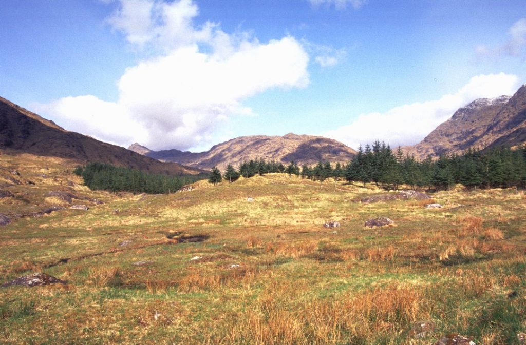
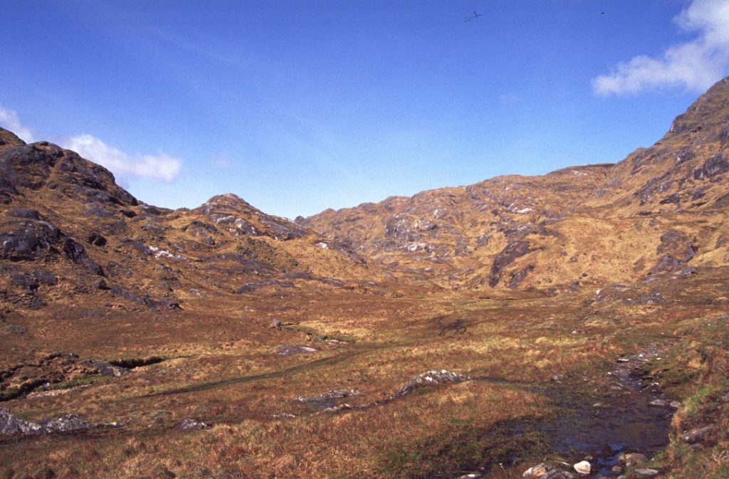
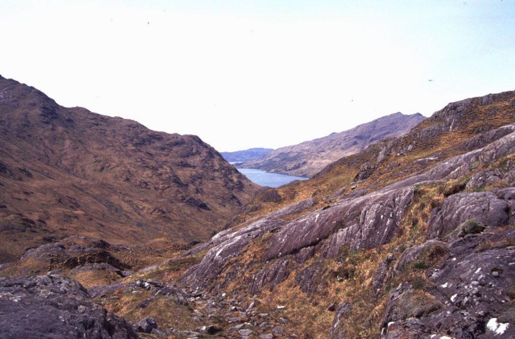
Erstmal Pause machen und überlegen, wie es weitergeht. Irgendwo weiter oben soll es einen relativ guten Fußpfad Richtung Skiary geben, den man von hier aus allerdings nur querfeldein erreichen kann. Wie komme ich also da hoch? Einige Stellen der vor mir liegenden Bergflanke sehen von unten nicht machbar aus. Viel zu steil. Der Tourenbeschreibung nach hätte ich hier hoch gemusst. Stattdessen bin ich dem Talverlauf zunächst weiter gefolgt und bin nach etwa 200 Höhenmetern auch irgendwann auf den Pfad gestossen. Dort angekommen, wo mir der Aufstieg von unten zu steil erschien, mache ich Pause und stelle fest, dass es letztlich kein Problem gewesen wäre. Ich konnte das als Flachlandtiroler nur nicht einschätzen. Die Aussicht zurück zum Loch Nevis entschädigt für die Mühen und das Wetter ist nach wie vor richtig richtig gut. Schon fast unwirklich für Schottland.
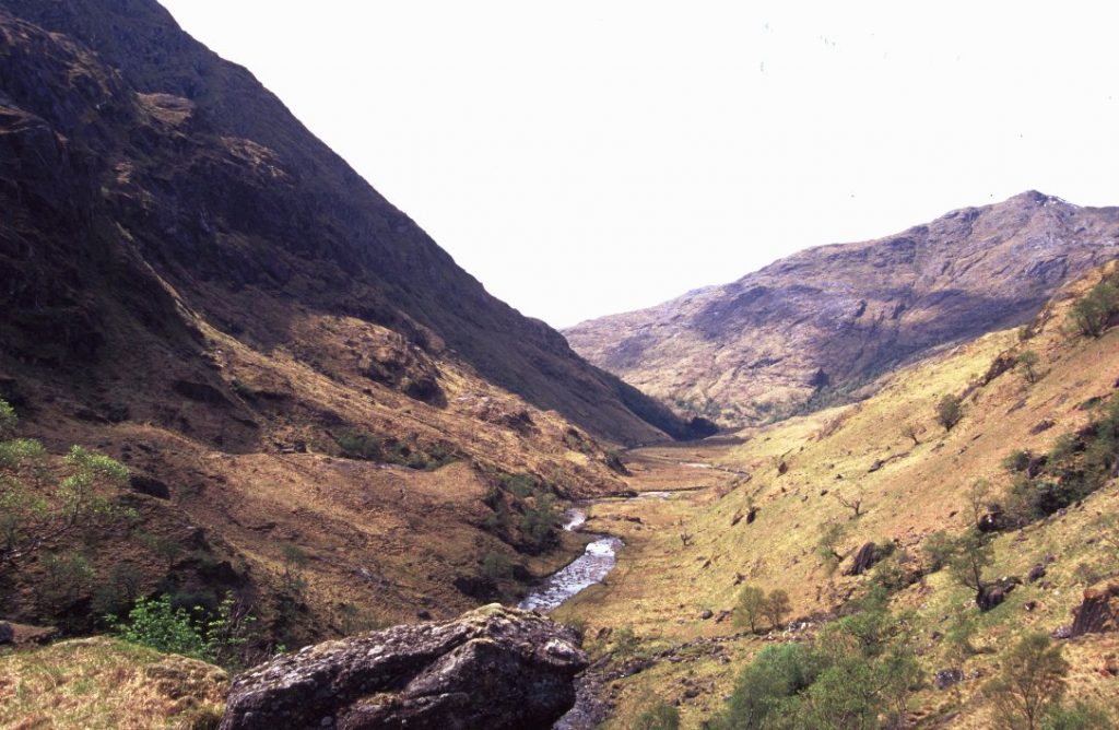
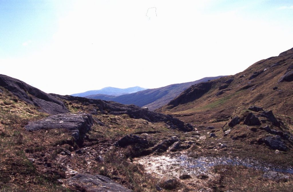
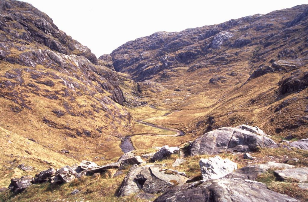
Nach der Pause geht es weiter, der Pfad fällt ins Gleann Unndalain ab. Ich bin etwa eine halbe Stunde bergab unterwegs, als sich Schmerzen in meinem rechten Knie entwickeln. Abstiege sind immer mit hohen Belastungen insbesondere für die Knie verbunden. Also erstmal eine kurze Pause, dann geht es weiter. Ich komme langsamer vorwärts und mache aufgrund der Schmerzen öfter Pause. Nach einer der Pausen ändert sich der Schmerz. Jedesmal, wenn das Knie unter Belastung abknickt, wird der Schmerz jetzt unerträglich. Drehe ich mich um und laufe aufwärts, geht es. Wird schon werden. Ibuprofen nehmen und weiter gehts. Wenn ich das Bein gerade halte als wäre eingegipst, geht es einigermaßen.
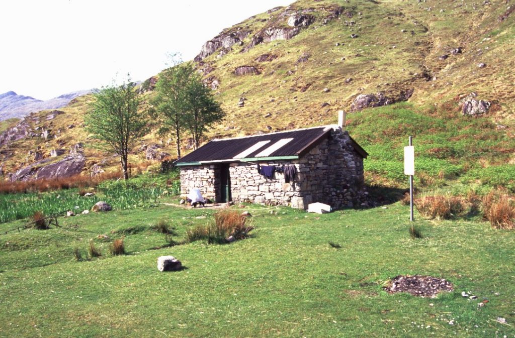
An der Barrisdale Bothy angekommen erkundige ich mich bei Leuten, die dort zelten, wie lange es wohl bis Skiary dauert. Ich bekomme die Info, dass Skiary lediglich ein Privathaus ohne Übernachtungsmöglichkeiten ist und der nächste Campingplatz bei Kinloch Hourn liegt, etwa drei Wegstunden entfernt. Das ist mir humpelnd und unter Schmerzen zu weit und so bleibe ich heute in der Bothy. Für morgen gönne ich mir einen Ruhetag, damit das Knie sich erholen kann.
Barrisdale ist eine private Bothy, in der die Übernachtung drei Pfund kostet. Dafür gibt es eine funktionierende Toilette, eine Küche mit fließend Wasser und sehr saubere Zimmer.
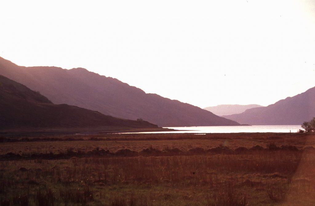
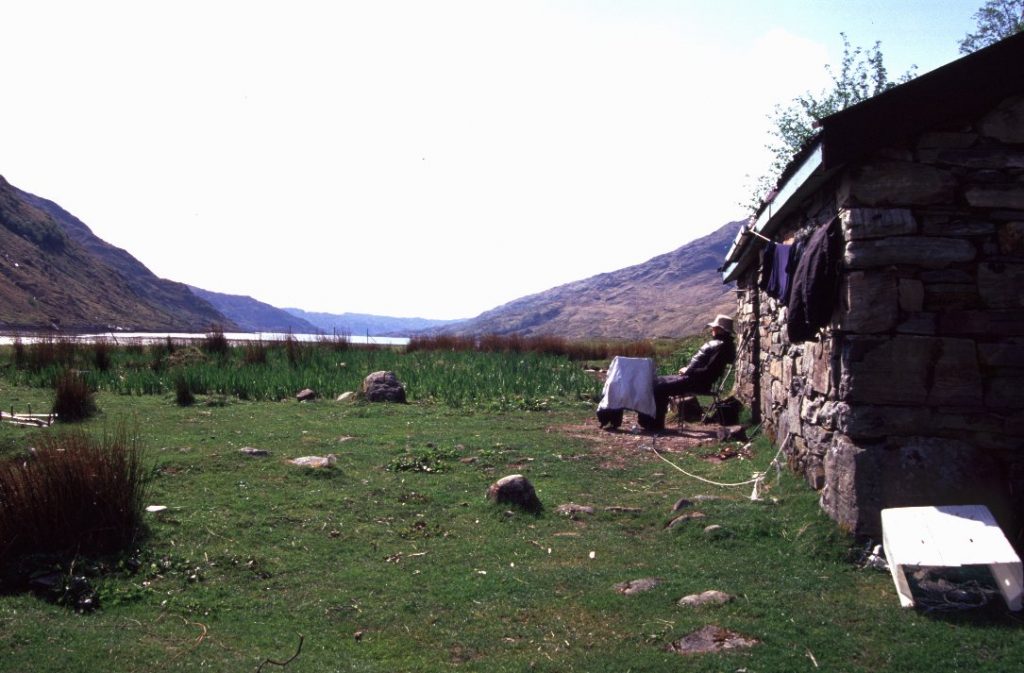
Ich genieße das gute Wetter vor der Bothy bei einem Becher Tee und freue mich trotz Schmerzen an dem guten Wetter und der Landschaft. Auf der einen Seite Loch Hourn, gegenüber die Highlands – genial.
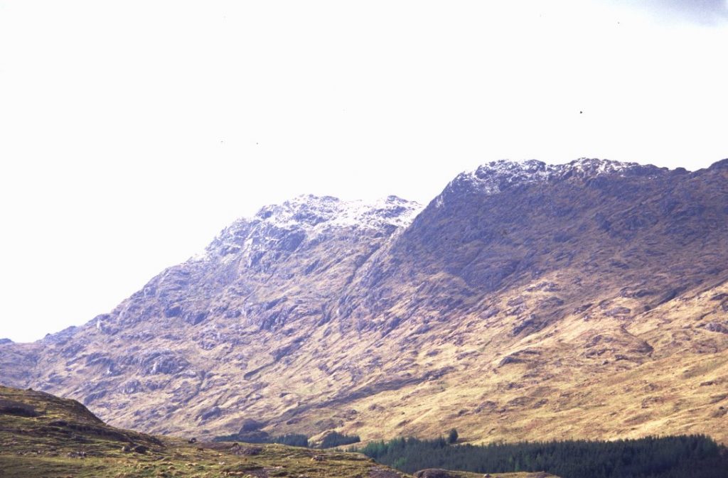
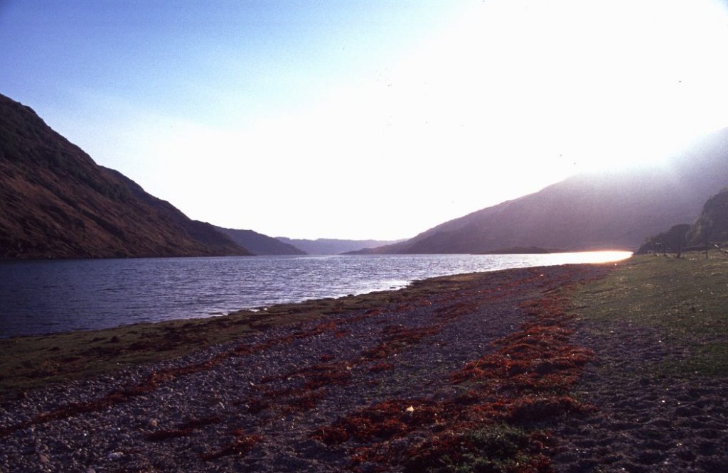
Der Ruhetag bringt wieder bestes Wetter und auch ein wenig Abwechslung – es ist Wochenende und diese Gegend bei den locals offensichtlich sehr beliebt, um ein paar Tage in der sehr schönen Landschaft zu verbringen.
Nur leider hat er dem Knie nicht geholfen, das tut jetzt auch beim Laufen ohne Gepäck in der Ebene gut weh. Nicht die besten Voraussetzungen für meine Urlaubspläne.
Getting up and leaving early I continue pathless towards a headland. The weather still is great and compensates for what I experienced last year.
There is a small bridge crossing River Carnach and after crossing the river I follow a small path running north east. A ruin soon comes into view. Assuming this is the ruin I wanted to camp at yesterday I wondered because the surrounding area looked completely different to what I remembered from pictures of the tour description. I checked my map and it turned out that I have followed the wrong river. Shit. Allt Achad a’ Ghlinne turns east but I had to follow a smaller stream to the north. So I walked back to where I crossed the river and followed a small and inconspicuous stream that I probably didn’t even notice before. It didn’t take long to reach that ruin and what a nice camp spot that is!
Having a break I wondered about how to reach a footpath that should be at higher elevation. According to the route description I had to ascend pathless from where I was now. But the surrounding terrain seemed to be way too steep. How to get up there without some serious scrambling with a heavy pack? Seen from my point of view it seemed impossible (…at least for me) so I followed the valley and instead of taking the direct approach gained altitude slowly. That worked out fine and I finally found that footpath running towards Skiary. Some time later I had a break where I originally should have ascended from that ruin. And guess what, from above it seemed to be no problem at all… but yeah, being unexperienced in mountaineering I simply made that decision for safety reasons which I think is better than overestimating my abilities.
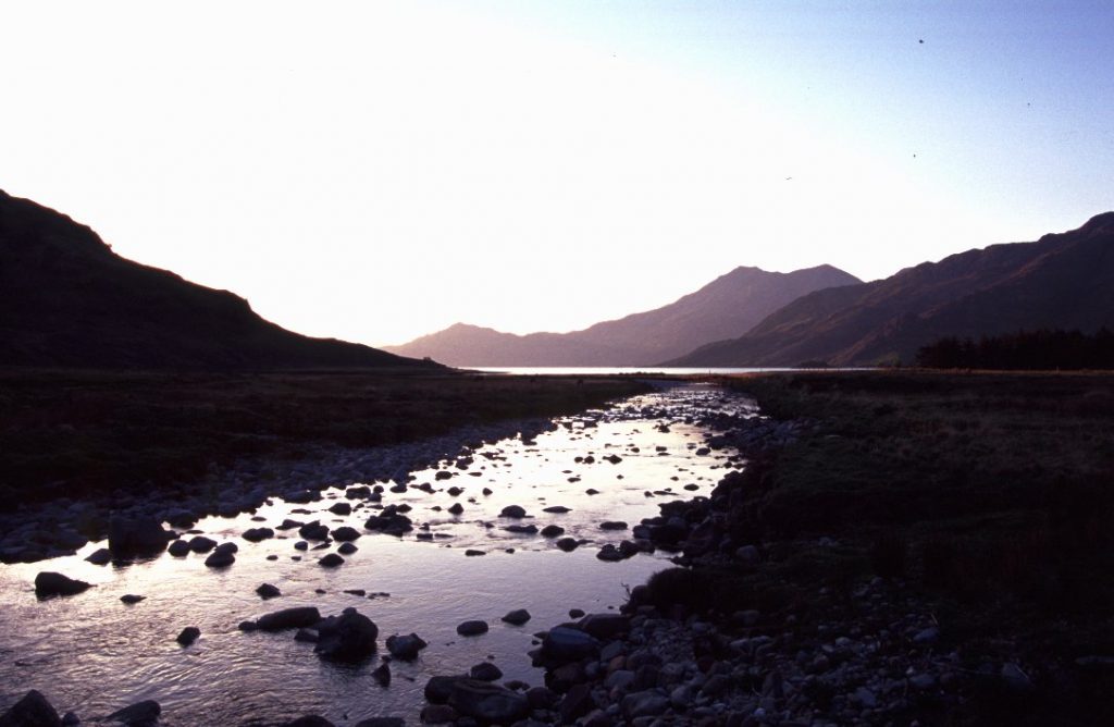
The incredible views of Loch Nevis and the surrounding area make up for all the effort and I try to take it all in while sitting there for a few minutes.
I descend into Gleann Unndalain and while walking, my right knee starts to hurt after about thirty minutes. Descents always put strain especially on your knees and it is a good idea to use trekking poles to reduce pressure. Having a short break I continue the descent but due to the pain my progress noticeably slows down. I have to rest regularly. While the pain at first was sort of dull and difficult to locate it changed after a while. When walking forward and bending the knee, pain becomes unbearable. Walking uphill is less painful, keeping the knee „locked“ straight has the same effect. Taking some Ibuprofen I continue walking downhill, staying up here is not an option.
Arriving at Barrisdale Bothy I ask some people camping next to the Bothy about the way to Skiary. What I did not know is that at Skiary there is a private house only and does not offer accommodation. Next campsite is at Kinloch Hourn and it should take about 3 hours to get there. Considering knee pain and humbling I decided that would be too much for me so I checked in at Barrisdale Bothy for two nights. Having a zero day tomorrow hopefully will help to recover.
Barrisdale is a private bothy offering a toilet, showers, a kitchen, tap water and nice clean rooms for three pounds per night.
Despite the pain I enjoy the good weather and the scenery to the full. Having a cup of tea and sitting down, Loch Hourn behind me, hills infant of me, simply great.
Weather stays fantastic, many people arrive and spend the weekend walking in this nice area. Unfortunately the zero day did not help to recover. Instead, walking on level ground and without a heavy pack now hurts too. Not the best prospects concerning my holiday plans.